Photos of VenturaCountyTrails. Click on an image to see it full size.
We took the jeep to
 |
On the Kelly Grade
|
|
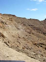 |
On the Kelly Grade
|
|
 |
Burned out coal seams on the Kelly Grade
|
|
 |
Burned out coal seams on the Kelly Grade
|
|
 |
On the other side of the canyon, you can vaguely make out burned coal seams there, too.
|
|
 |
On the Kelly Grade
|
|
 |
Smokey Mtn Road, near the bottom of the Kelly Grade
|
|
 |
Smokey Mtn Road, near the bottom of the Kelly Grade
|
|
 |
Smokey Mtn Road, near the bottom of the Kelly Grade
|
|
 |
Smokey Mtn Road, near the bottom of the Kelly Grade
|
|
 |
At the bottom of the Kelly Grade
|
|
 |
Smoky Mountain Road
|
|
 |
Smoky Mountain Road, looking back up at the Kelly Grade
|
|
 |
Smoky Mountain Road
|
|
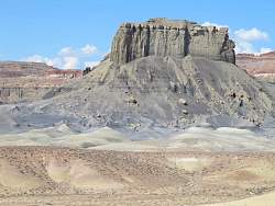 |
Smoky Mountain Road
|
|
 |
Smoky Mountain Road
|
|
 |
Smoky Mountain Road
|
|
 |
Smoky Mountain Road
|
|
 |
Smoky Mountain Road
|
|
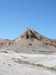 |
Smoky Mountain Road
|
|
 |
We stopped here to find a geocache.
|
|
 |
These are called toadstools. The rock on top is about 20' across.
|
|
 |
The landscape is pretty bleak at the bottom of the Smoky Mountain Road
|
|
 |
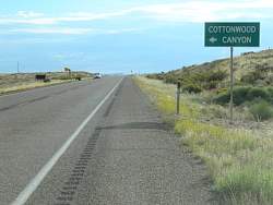
There are lot of signs for the middle of nowhere!
|
|
 |
We saw this photo at the visitors center as a warning to be careful
|
|
 |
View beside Rt 89 on the way to Kanab
|
|
 |
Google Earth view of Cottonwood Canyon Road, looking north
|
|
 |
With a closer view, you can see the cockscomb formations that line the canyon, especially on the east (right) side.
|
|
 |
Cottonwood Canyon Road
|
|
 |
Cottonwood Canyon Road
|
|
 |
Cottonwood Canyon Road
|
|
 |
Cottonwood Canyon Road
|
|
 |
Cottonwood Canyon Road. Now you can see some of the cockscomb formations
|
|