Photos of VenturaCountyTrails. Click on an image to see it full size.
We took the jeep to
 |
Google Earth view of our route along Hell's Backbone Rd looking north, starting at Escalante in the lower left and ending at Boulder
|
|
 |
Google Earth view of Hell's Backbone Road, looking south, where the road crosses the Hell's Backbone bridge at the switchbacks (lower center).
|
|
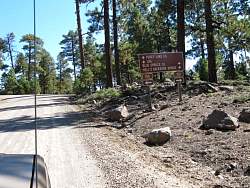 |
We took a short side trip to Posey Lake
|
|
|
|
|
 |
Posey Lake.
|
|
 |
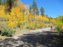
The trees are turning on Hell's Backbone Road
|
|
 |
Hell's Backbone Road
|
|
 |
Hell's Backbone Road
|
|
 |
Hell's Backbone Road
|
|
 |
Hell's Backbone Road
|
|
 |
Hell's Backbone Road
|
|
 |
Hell's Backbone Road
|
|
 |
Hell's Backbone Bridge
|
|
 |
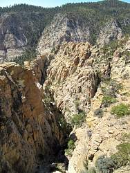
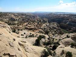
Canyon of Hell's Backbone
|
|
 |
Canyon of Hell's Backbone
|
|
 |
Hell's Backbone Road
|
|
 |
Hell's Backbone Road
|
|
 |
Reading material at the restaurant where we had lunch
|
|
 |
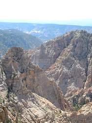
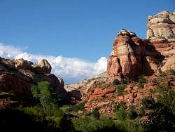
View of Calf Creek from Hogback Ridge, looking upstream
|
|
 |
View of Calf Creek from Hogback Ridge, looking downstream
|
|
 |
View of Calf Creek from Hogback Ridge
|
|
 |
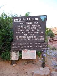
Calf Creek Trail. There were no spare dog leashes when we were there.
|
|
 |
Calf Creek Trail
|
|
 |
Calf Creek Trail
|
|
 |
Calf Creek Trail
|
|
 |
Calf Creek Trail
|
|
 |
Calf Creek Trail
|
|
 |
Calf Creek Trail
|
|
 |
Calf Creek Trail
|
|
 |
Calf Creek Trail
|
|
 |
Calf Creek Trail
|
|
 |
Calf Creek Trail
|
|


