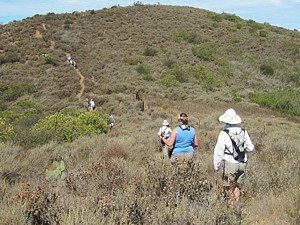
Looking
south over Rancho
Potrero with Boney Mountain in the distance on the left and homes
of Dos Vientos in the foreground
Rancho Potrero
Open Space
including
the western part of Rancho Sierra Vista/Satwiwa
|
|
The northern half of the Rancho Potrero Open Space consists of rolling grassland that ends at an east-west ridge that affords great views over these grasslands and the community of Dos Vientos to the north, and into Pt. Mugu State Park to the south. This is not a large open space so the trails here aren't very long, but it provides important interconnections between other areas. Its trails lead into Rancho Sierra Vista/Satwiwa to the east and then Pt Mugu State Park, and a short jaunt on pavement gets you to Dos Vientos trails to the north. To the west and immediately south is private property with no public access.
There are only a few official trails in this open space, but the nature of the terrain and the ajoining equestrian center has led to many unofficial trails, most of which are quite well used, including along the top of the south ridge. They are indicated by dotted brown lines on the map.
Rancho Potrero was transferred from the MRCA to COSCA around 2006. It had been purchased in 1993 by the MRCA, the city of Thousand Oaks and the CRPD, but held in trust by the MRCA.
|
|
a. Main parking on Potrero Road. There are bathrooms here. Map
and directions.
b. On the south side of Potrero Road. Map
and directions.
c. Equestrian parking on the driveway to Rancho
Sierra Vista/Satwiwa. Map
and directions.
d. The old entrance on Potrero Rd at Pinehill
Ave. Map
and directions.
e. The main parking for Rancho Sierra Vista/Satwiwa.
There are bathrooms here. Map
and directions.
f. Trailheads in Dos
Vientos.
z. Locked gate. Private propery beyond this point. No
public access.
Download the GPS tracks ![]() to help you find your way. Because these trails are relatively quite short,
all official trails and the unofficial South Ridge Trail are included in this
one GPX file.
to help you find your way. Because these trails are relatively quite short,
all official trails and the unofficial South Ridge Trail are included in this
one GPX file.
Description This old paved road leads from parking on Potrero Road to the site of the old Olympia Farms where all that is left is the foundation of some old ranch building. If you don't like using the pavement, there is an unofficial dirt path next to it until it meets Palomino Trail.
Download the GPS track ![]() to help you find your way.
to help you find your way.
Technical Rating T0
![]()
|
Length (miles) |
0.6 |
|
Climb (feet) |
70 (starting at Potrero Road) |
|
Descent (feet) |
40 |
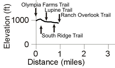
Trail Profile Back to the Top

 Description This connects
the paved Olympia Farms Trail to the Ranch Overlook
Trail in Rancho Sierra Vista/Satwiwa.
About 250 yards of the west end are paved where it climbs a hill to a flat area
with a few big trees that makes a good lookout.
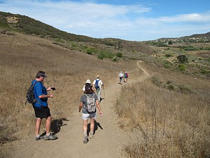
The photo at right shows the paved west section with the Olympia Farm site in the distance at the left edge.
Download the GPS track ![]() to help you find your way.
to help you find your way.
Technical Rating T2
![]()
|
Length (miles) |
0.9 |
|
Climb (feet) |
80 (West to east) |
|
Descent (feet) |
170 |
Trail Profile Back to the Top

Description This short, quarter-mile long trail connects the main parking area on Potrero Road to the Grasshopper and Palomino Trails.
Download the GPS track ![]() to help you find your way.
to help you find your way.
Technical Rating T2
![]()
|
Length (miles) |
0.22 |
|
Climb (feet) |
40 (North to south) |
|
Descent (feet) |
10 |
[4] Grasshopper Trail
Description This trail leads from the main parking area to the Ranch Overlook Trail in Rancho Sierra Vista/Satwiwa. Most of it runs just south of a depression that gets swampy during the rainy season.
Download the GPS track ![]() to help you find your way.
to help you find your way.
Technical Rating T2
![]()
|
Length (miles) |
0.54 |
|
Climb (feet) |
10 (West to east) |
|
Descent (feet) |
40 |
[5] Edison Access Trail
 Description This narrow
dirt road follows the power poles along a ridgeline so it's a little more hilly
than most of the other trails in this area. From the east, it starts at Pinehill
Road, crosses the paved driveway to Rancho Sierra Vista/Satwiwa and ends shortly
thereafter at the equestrian facility.
Download the GPS track ![]() to help you find your way.
to help you find your way.
Technical Rating T1
![]()
|
Length (miles) |
0.5 |
|
Climb (feet) |
45 (West to east) |
|
Descent (feet) |
70 |
[6] South Ridge Trail
 Description This unofficial
trail climbs up to and then follows along the ridge that marks the highest part
of this open space. As a ridgeline trail it is much steeper than the rest, and
even too steep for most mountain bikers to climb, but it affords views in all
directions. It connects to the Palomino Trail at both ends.
Download the GPS track ![]() to help you find your way.
to help you find your way.
Technical Rating T2.5
![]()
|
Length (miles) |
0.8 |
|
Climb (feet) |
260 (East to west) |
|
Descent (feet) |
120 |
Trail Profile Back to the Top

 Description This is
the westernmost trail of Rancho Sierra
Vista/Satwiwa. At the north end, it connects to the Edison Access just a
few feet from the driveway, and close to Potrero Road. It connects to the main
Sycamore Canyon Trail at the south/east end. From the north, it's a broad doubletrack,
and perhaps slightly loose. At the Palomino Trail, it narrows somewhat. The
eastern third is a bit hilly and rutted, hence the T2.5 rating. Short spurs lead
to the equestrian parking in the north and the main parking in the middle. There
are 'Closed to Bikes' signs along the trail, but it's not clear to me where
it's closed to bikes and where it's open to everybody.
Download the GPS track ![]() to help you find your way.
to help you find your way.
Technical Rating T2.5
![]() (part
is NB
(part
is NB
![]() )
)
|
Length (miles) |
1.0 |
|
Climb (feet) |
90 |
|
Descent (feet) |
150 |
Trail Profile Back to the Top

Description This paved road leads from Potrero Road to the main parking lot for Rancho Sierra Vista/Satwiwa.
Download the GPS track ![]() to help you find your way.
to help you find your way.
Technical Rating T0
![]()
|
Length (miles) |
0.6 |
|
Climb (feet) |
15 (From Potroro Road to the main parking lot) |
|
Descent (feet) |
100 |
[9] Old Entrance Trail (Pinehill Ave.)
Description This gravel road was the original entrance to Rancho Sierra Vista/Satwiwa and Pt Mugu State Park before the Dos Vientos neighborhood was developed. It leads from Potrero Road at Pinehill Avenue to the main parking area. It is noticably broader south of where the Edison Access joins it.
Download the GPS track ![]() to help you find your way.
to help you find your way.
Technical Rating T0.5
![]()
|
Length (miles) |
0.35 |
|
Climb (feet) |
75 (From Potrero Road to the main parking area) |
|
Descent (feet) |
65 |
Description This road leads from the private property to the east of Rancho Potrero to the private property to the south, and connects to the end of the Olympia Farms Trail. There are locked gates at both ends to keep the public from continuing beyond the open space. Please respect the landowner's wishes.
Download the GPS track ![]() to help you find your way.
to help you find your way.
Technical Rating T1
![]()
|
Length (miles) |
0.4 |
|
Climb (feet) |
35 |
|
Descent (feet) |
100 |
Trail Profile Back to the Top

This page was last updated December 6, 2020
|
|
Thanks for looking at Steve's guide to trails in Ventura County, the Santa Monica Mountains National Recreation Area (SMMNRA) and other locations. |
|