 |
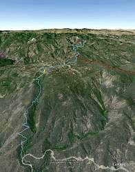
3-D map of the Ortega OHV Trail, courtesy of Google Earth, looking north-west. Highway 33 is at the bottom. The red line is Dry Lakes Ridge, and purple is 23W07 that goes through the Matilija Wilderness.
|
|
 |
The trail is rated "Most Difficult." That's not promising!
|
|
 |
It's a little rocky at the bottom, but nothing bad
|
|
 |
This tree is a few feet from the trail
|
|
 |
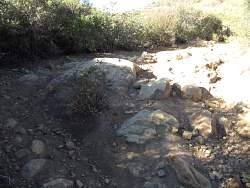
Must have been a fire here years ago. The Forest Service might want to look into putting in a new sign.
|
|
 |
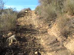
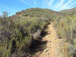
The trail is getting a little more rocky, but still not too bad
|
|
 |
The main trail, just right of straight ahead, is pretty bad, but people have found a new route to the left, around the big rock
|
|
 |
Once we start to climb up the switchbacks, the trail is much better
|
|
|
 |
However, the top of the switchbacks are a little chewed up
|
|
 |
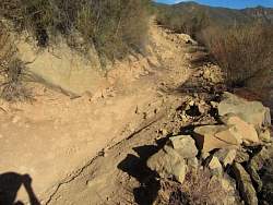
Now it's a little rocky and loose, but still okay
|
|
 |
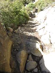
The rocks are getting bigger
|
|
 |
Beyond the switchbacks, the trail surface is really good
|
|
 |
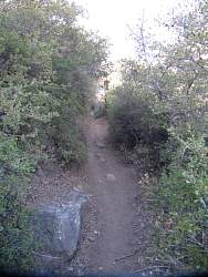
On the north side of the ridge, the trail is shaded and a little overgrown in spots
|
|
 |
This part looks like it would be a lot of fun!
|
|
 |
Those rocks are too tough for me. Fortunately this is a waterfall and not the trail!
|
|
 |
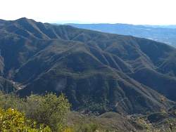
From a trail spur, we can see the lake behind Matilija Dam to the south. It's just to the right of dead center.
|
|
 |
Zoomed in, the lake and even the dam, are easier to see
|
|
 |
On the other side of the 33 are switchbacks that lead to Nordhoff Ridge Rd
|
|
 |
Back to the trail, it looks really good here...
|
|
 |
...This would be trouble, but I don't think I would break anything climbing over those rocks...
|
|