3-D map of the Ortega OHV Trail, courtesy of Google Earth, looking north-west. Highway 33 is at the bottom. The red line is Dry Lakes Ridge, and purple is 23W07 that goes through the Matilija Wilderness.
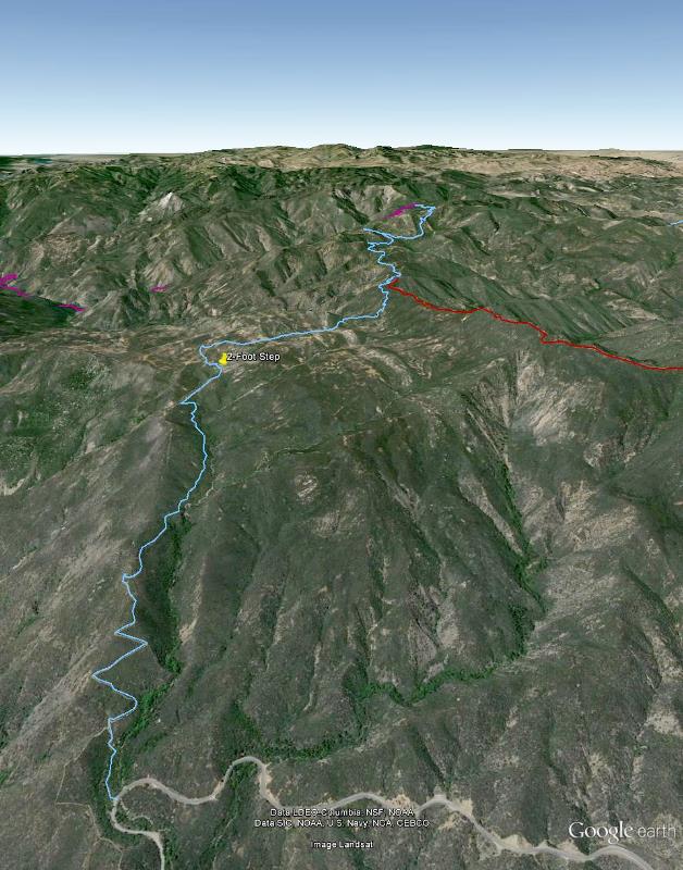
Image 1 of 41
3-D map of the Ortega OHV Trail, courtesy of Google Earth, looking north-west. Highway 33 is at the bottom. The red line is Dry Lakes Ridge, and purple is 23W07 that goes through the Matilija Wilderness.
|
||
|
|
Image 1 of 41 |
|
|
Image 1 of 41
|
