 |
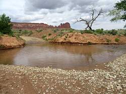
My route to Beef Basin is blocked by this river. Fortunately it's near the beginning of the ride.
|
|
|
|
 |
The view from my campsite
|
|
 |
My campsite at the Needles Outpost. I thought it was a great setting, especially as it only cost $15/night.
|
|
 |
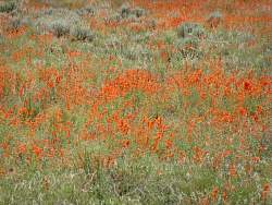
There orange flowers were everywhere in the flats. I wish I learned what they were called.
|
|
 |
There are lots of flowers in this meadow!
|
|
 |
This is part of the previous panorama where there were the most flowers.
|
|
|
 |
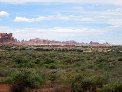
The La Sal Mountains in the distance. Yesterday, when I was up there, the peaks were always covered by clouds. Today, not so much.
|
|
|
|
 |
The first four miles could be traversed by the average Toyota. After that, it was really rugged. I had to follow the black tire marks on the slickrock to find the way. It's about 7 miles to the overlook.
|
|
|
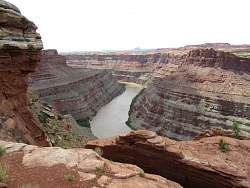 |
At the overlook it's about 900' down to the river. This is the view down river (southwest).
|
|
 |
Looking upriver
|
|
 |
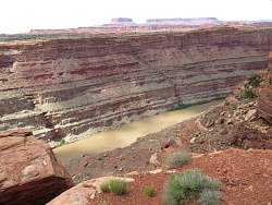
There's a tour boat down in the river.
|
|
 |
There's some butte in the far distance to the west.
|
|
 |
Panorama of the Colorado River Overlook.
|
|
 |
In the distance, Junction Butte (top center) and Island in the Sky (top right)
|
|
 |
A closer look at Junction Butte and Island in the Sky
|
|
|
|
 |
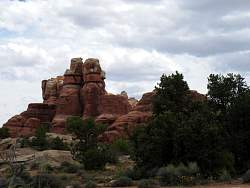
Nearby rock formations
|
|
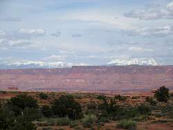 |
Another view of the La Sal Mountains. Those cloud-free peaks taunted me all day!
|
|
|
|
|
|