|
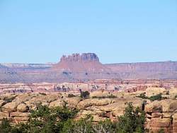
Google Earth view of the Needles District, looking west, from just east of the Needles Overlook. The near river is the Colorado, and the far one, behind Island in the Sky, is the Green.
|
|
 |
Google Earth view of my ride along Lockhart Basin Road from the Needles Visitors Center (center right) to the Colorado River (lower left). The view looks south-east. The rock outcropping in the lower right corner is part of Island in the Sky.
|
|
 |
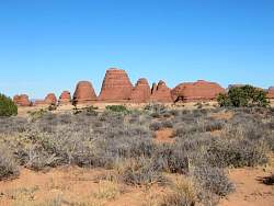
View of the Needles District from my campsite shortly after sunrise.
|
|
 |
Zoomed-in view from my campsite
|
|
 |
Zoomed-in view from my campsite
|
|
|
 |
The Wooden Shoe Arch, in silhouette.
|
|
 |
A better view of Wooden Shoe Arch, at the right.
|
|
|
 |
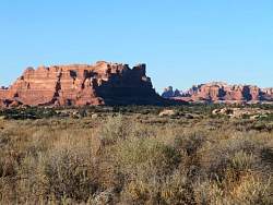
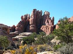
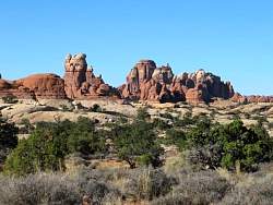
View of the Needles from beside the road to Elephant Hill.
|
|
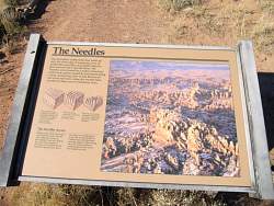 |
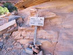
Sign at the overlook where the previous photo was taken. The photo on this sign is the best view of the Needles that I saw anywhere in the park.
|
|
 |
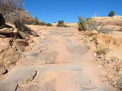
The start of the Elephant Hill 4WD road. It doesn't look so bad here...
|
|
 |
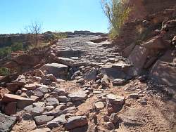
Unfortunately, to get to the most scenic parts of the Needles District by vehicle, you need to traverse this road. I hiked it to see what it was like.
|
|
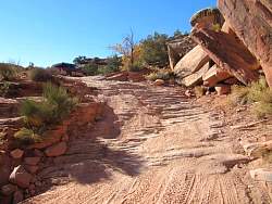 |
The first technical part of the Elephant Hill 4WD road. The car at the top is turning around because it gets worse. Then it gets much worse...
|
|
 |
Looking back down the 'road' I watched the car turn around. The 'level' area there wasn't very large, but the car didn't go over the edge.
|
|
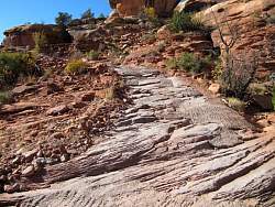 |
Looking upwards, there are places where the holes have been filled with concrete, with partial success in making the road more drivable.
|
|
|
 |
This is the first real switchback. What you can't see is that there is a large area behind me where a car can turn around fairly easily.
|
|
|
|
|
 |
This is just about to the top. From here it's relatively flat for a few hundred yards, then it starts down the other side, steeper than it was to get up here!
|
|
 |
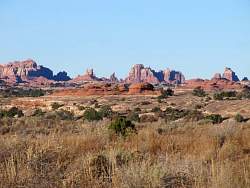
View from the top of Elephant Hill 4WD road.
|
|
 |
View from the top of Elephant Hill 4WD road.
|
|
 |
View from the top of Elephant Hill 4WD road.
|
|
 |
View from the top of Elephant Hill 4WD road.
|
|
 |
View from the top of Elephant Hill 4WD road.
|
|
 |
View from the top of Elephant Hill 4WD road.
|
|
 |
Time to start down...
|
|
|
 |
Looking back up the hill shown in the previous photo
|
|
 |
Looking back up the next steep section. This hill looked to be about 45-degrees.
|
|
|
 |
This was interesting. There wasn't enough room to turn around at the switchback, so a jeep would have to back down to the next switchback, then continue forward to the bottom! Coming up would be the same story.
|
|