|
The road to Mineral King in cyan, as seen from Google Earth looking north-east. It takes 1.5 hours to drive this 25-mile long road!
|
|
 |
The Mineral King Road in cyan as seen from Google Earth, looking north-west. Our hike track is the yellow line near the top end of the road.
|
|
|
|
|
|
 |
Most of the road was paved, but a couple of sections near the top were dirt.
|
|
|
|
 |
Parking at our trailhead (there are several trailheads)
|
|
 |
Cars are protected from marmot attack from below!
|
|
|
|
 |
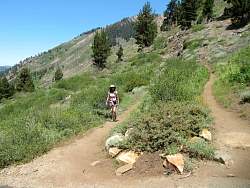
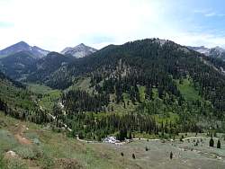
We ended up hiking in that direction, on the Timber Gap Trail
|
|
 |
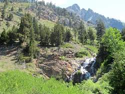
But first, we had to explore a nearby waterfall!
|
|
|
|
|
|
|
|
|
 |
There's a cave at the base of the waterfall, on the right edge of this photo. We didn't get any closer to it than this.
|
|
 |
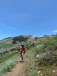
Hikers coming down from one of the trails above us
|
|
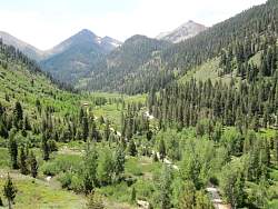 |
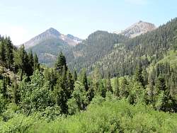
As we climb the trail towards Timber Gap, our view of the valley and mountains changes constantly
|
|
|
|
|
 |
There were millions of caterpillars all over the ground, bushes and trails.
|
|
 |
The little dark spots on the trail in the foreground are caterpillars
|
|
|
|
|
|
|
|
|
|