|
Our route, as shown in Google Earth, looking due East. We started at the lower left, next to the freeway.
|
|
 |
Our route, as shown in Google Earth, looking due West. We started near the center of the image, next to the freeway.
|
|
 |
This tree fell down but is still thriving
|
|
 |
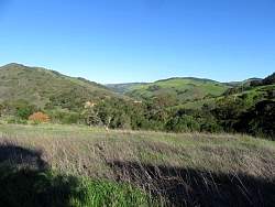
Near the bottom of the Gaviota Peak Fireroad
|
|
|
 |
We turned off onto Trespass Trail. Our loop hike would bring us back down this fireroad.
|
|
|
|
|
|
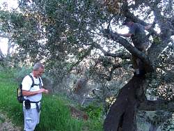 |
We were geocaching as well as hiking. This one was up in the tree!
|
|
 |
North(west) of us we can see where Hwy 1 splits off from the 101 freeway.
|
|
 |
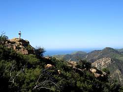
This is a very attractive viewpoint, but nothing compared to what we'll soon see!
|
|
|
|
|
 |
South of us, the 101 winds through some rocky ridges
|
|
 |
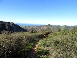
The trail is headed mostly eastward now.
|
|
 |
We continued up the Trespass Trail
|
|
|
 |
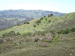
Loooking back. This looked like a meadow from a distance, but really it was a flat area that had burned some years ago and now had a cover of chaparall that was all the same height.
|
|
|
 |
Bush sunflowers at the side of the trail
|
|
|
|
|
|
 |
The trail continues east and up
|
|
 |
A blue dick, aka wild hyacinth
|
|
|
|
|
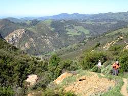 |
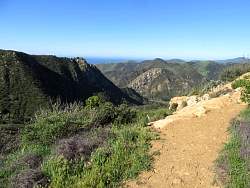
There's really a fantastic view behind us!
|
|
|
 |
A lupine
|
|
 |
A morning glory blossum
|
|
 |
More bush sunflowers
|
|