 |
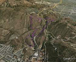
Google Earth view of our route (purple), looking from the south-west. Simi Valley is in the foreground and the San Fernando Valley in the background. We hiked counter-clockwise.
|
|
 |
At the Santa Susana Pass trailhead to Rocky Peak Motorway.
|
|
 |
Starting up Rocky Peak Motorway. The surface is in good shape here.
|
|
 |
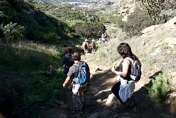
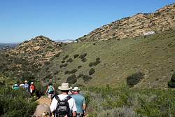
Pausing to learn about the hike
|
|
 |
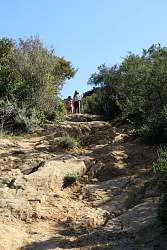
Climbing Rocky Peak Mtwy, the surface is pretty broken up!
|
|
|
 |
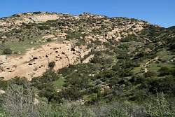
This is where we turned down a goat track of a trail that leads to a wildlife crossing under the 118 freeway.
|
|
|
 |
Starting downt the goat-track trail with Simi Valley visible in the distance
|
|
|
|
 |
Most of the trail is really steep, but the surface was firm so not too slippery. Mostly.
|
|
|
|
|
|
|
|
|
|
|
|
|
|
|
|
|
|
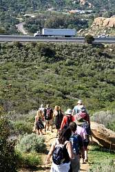 |
We're getting closer to the freeway
|
|
|
|
 |
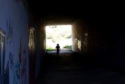
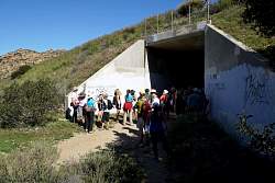
The wildlife crossing goes under the freeway
|
|
|
|
|
|
|
|
|
|
|
 |
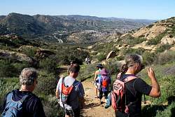
The view from the south side of the freeway.
|
|
 |
Waiting for everyone to get down the goat track before continuing down to Corriganville
|
|
|