 |
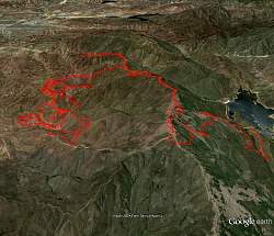
View of trails I rode at and near Rowher Flat, in red, as seen with Google Earth. Rower Flat is on the left and the Bouguet Reservoir is to the right. The road along the top of the ridge between them is Sierra Pellona Motorway.
|
|
 |
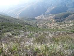
One of the first things I wanted to do was ride to the top of the ridge to see if I could get a better sense of all the trails at Rowher Flat. When I got to the top, I could see these huge white pipes on the other side.
|
|
 |
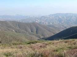
My bike on Sierra Pellona Mtwy, looking east. You can vaguely see the motorway along the top of the ridge stretching out in the distance, and anothr trail below it to the right. I rode the motorway but not that trail.
|
|
 |
Looking back down on Rowher Flat...
|
|
 |
... a zoomed-in view of Rowher Flat...
|
|
 |
... and an even more zoomed-in view. The trails in the upper part of the picture are the "Play Area."
|
|
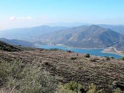 |
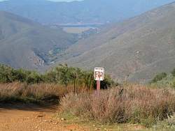
When I got further east on the ridge, I had a good view of the reservoir. I had seen a lake on the north of Rowher Flat, but I didn't realize it was a reservoir, and that close.
|
|
|
 |
Sierra Pellona Mtwy where one of the steep and rocky trails comes up from Rowher Flat
|
|
 |
A very very rare tree on an otherwise pretty bleak landscape. I would see two of these the next day, also near the top of the ridge, but one of them might have been this one again.
|
|
 |
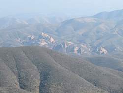
Big rocks in the distance
|
|
|
 |
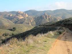
This was as far to the south-west on the ridge I went. The next day I rode all the way down that road to the bottom.
|
|
 |
From this far to the west, you can see the dam that holds the reservoir...
|
|
 |
Getting closer to the dam. There's a trail here that leads down to Bouquet Canyon.
|
|
 |
There were a number of ridgeline roads and trails that ran up to the tops of all the local peaks and down again. I rode some of them on the way back, but not this one. Good thing I rode them because the next day a bulldozer came through and dug them all under!
|
|
 |
Getting a better and better view of that dam as I ride north-east and closer.
|
|
 |
On my way back down, on the Fall Canyon Truck Trail, I get a good view of a trail climbing from Rower Flat
|
|
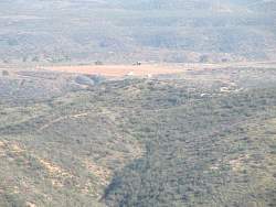 |
The main staging area of Rowher Flat has one lonely vehicle in it
|
|
 |
A closer look at the big rocks I could see from the top
|
|
 |
This is Texas Trail, a wide and well-used off-road trail that runs above Texas Canyon Truck Trail. You can see other trails climbing the hills in the distance
|
|
 |
Some of those trails loop pretty steep from here!
|
|
 |
The sun shines through clouds onto the Kids Area
|
|
 |
A brigher exposure of the Kids Area
|
|