Our route as seen from Google Earth, in light blue. The view is from south-east. The orange arrow shows our start point at the north end of Las Virgenes Canyon Rd. We hiked counterclockwise around the loop.
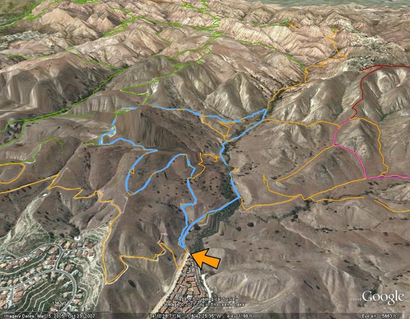
Image 1 of 39
Our route as seen from Google Earth, in light blue. The view is from south-east. The orange arrow shows our start point at the north end of Las Virgenes Canyon Rd. We hiked counterclockwise around the loop.
|
||
|
|
Image 1 of 39 |
|
|
Image 1 of 39
|
