Click on an image to see it full size.
 |
A 180-degree view looking west from Hurrah Pass near Moab.
|
|
 |
A 360-degree panorama of Lockhart Basin along the Colorado River.
|
|
 |
Heading back down towards Moab from Hurrah Pass, a view of Kane Springs Creek. You can see its path from the green trees that grow beside it.
|
|
 |
The La Sal Mountains to the east, from Moab
|
|
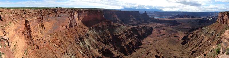 |
From the overlook near the Visitors' Center in Dead Horse Point State Park
|
|
 |
The Dead Horse Point Overlook has a stunning view of the Colorado River
|
|
 |
Another view fro Dead Horse Point Overlook. You can see Potash Road, on this side of the river, that leads from Island in the Sky back to Moab.
|
|
 |
A 180-degree view of the Colorado River at Mineral Bottom.
|
|
 |
The potash evaporation poind. They add color to the water to make it evaporate faster.
|
|
 |
The valley through which Onion Creek flows. The La Sal Mountains are to the west and south.
|
|
 |
Along Onion Creek Road
|
|