 |
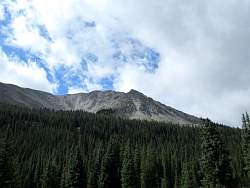
The top of Mt Antero, one of the places I plan to ride, is covered with clouds. I hope that's not an omen for the day - it's hard to see the views from within a cloud. Also, sometimes they leak rain out!
|
|
 |
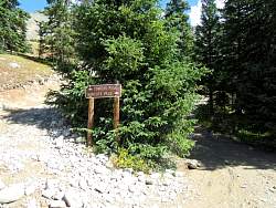
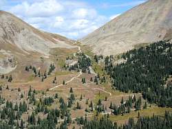
On the way to Tincup Pass, trees block much of the view.
|
|
 |
Almost to the pass, and mostlly above the tree line.
|
|
 |
Looking north-west from the continental divide. That's the direction I would be going if I were to continue on.
|
|
 |
Looking south-east from the continental divide. That's the way I came, and the way I would go back.
|
|
 |
The way back down, from a few hundred feet from Tincup Pass.
|
|
 |
Now, on to Hancock Pass!
|
|
|
 |
The last part of the road was very rocky. Most of it was very well maintained and smooth.
|
|
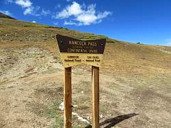 |
Another point on the continental divide.
|
|
 |
Looking back down the way I came up, to the north-east.
|
|
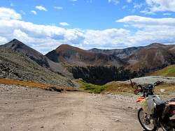 |
Looking south-west. The road ahead leads to Tomichi Pass.
|
|
 |
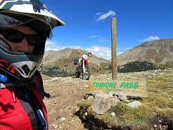
The Tomichi Pass road
|
|
|
|
 |
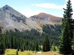
From Tomichi Pass, the road continues on to the south and west.
|
|
 |
The road that leads back to Hancock Pass. It's steeper than it looks in this photo.
|
|
 |
The road that I took to get to Tomichi Pass.
|
|
 |
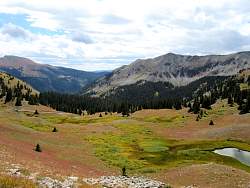
Lunch time. What a view!
|
|
|
 |
The last trail for the day was up Mt. Antero. It was constantly uphill, moderatelly steep, and always very rocky. Once the trees were out of the way, there were some spectacular views.
|
|
|
|
|
|
|
|
 |
This is where I turned around, about 4.2 miles up the 7 mile road. I'd bounced around enough on the rocks for one day!
|
|
 |
The following pictures were taken on the way back down the Mt. Antero jeep trail to the main road.
|
|
|
|
|
|
|
|
 |
The next day, the weather was much more sunny, but it was time for me to head to the next riding area.
|
|
|