|
The Sky Pilot suspension bridge, with Sky Pilot and Copilot Mountains visible in the upper left.
|
|
 |
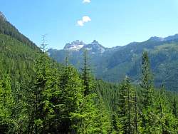
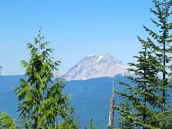
In case you're wondering what mountains you can see in the distance
|
|
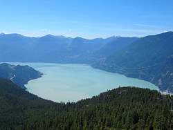 |
There's a great view of Howe Sound from up here!
|
|
 |
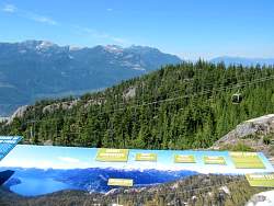
The top of the Sea to Sky Gondola
|
|
 |
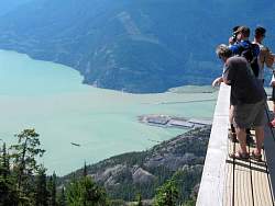
The summit viewing deck overlooks Howe Sound
|
|
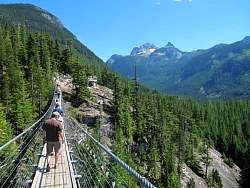 |
Crossing the Sky Pilot Suspension Bridge, with Sky Pilot and Copilot Mountains visible in the distance.
|
|
 |
Looking back at the Summit Plaza from the suspension bridge
|
|
|
 |
Sky Pilot Mountain. Copilot is hidden by a tree.
|
|
|
|
 |
Brohm Peak, to the north-northeast.
|
|
|
 |
Brohm Peak again
|
|
|
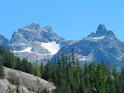 |
Zoomed-in view of Sky Pilot (left) and Copilot (right.
|
|
 |
Overlooking Squamish to the north
|
|
 |
Howe Sound near Squamish is full of wind surfers and kite surfers
|
|
 |
Part of the Stawamus Chief, with Squamish in the background
|
|
|
|
|
 |
Another view of the wind- and kite-surfers
|
|
 |
The Summit Plaza from the Lookback Viewpoint
|
|
 |
The Sea to Sky Highway (Hwy 99). Traffic headed to Vancouver is backed up going up the hill.
|
|
 |
There were bushes loaded with blue huckleberries everywhere!
|
|
 |
The bottom of the Sea to Sky Gondola
|
|
|
|