|
|
|
|
 |
Beware of thieves!
|
|
 |
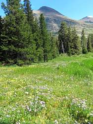
Clements Mtn (8760') behind the Visitors' Center at Logan Pass
|
|
 |
Hikers on the Hidden Lake Nature Trail (tiny dark dots against the snow in the center-left) behind the Logan Pass Visitors' Center, mostly hidden by the shadow of a cloud.
|
|
|
|
|
 |
St. Mary Lake from Hwy 89, heading south.
|
|
 |
The next several photos are from the Two Medicine area in the south-east corner of Glacier National Park. Here we see Rising Wolf Mountain and Two Medicine Lake.
|
|
 |
RIsing Wolf Mtn is 9513' high
|
|
|
|
|
|
|
|
|
|
|
|
|
|
|
|
|
 |
St. Mary Lake from Hwy 89 (again).
|
|
|
 |
St. Mary Lake on a windless morning, looking south-east from the Going to the Sun Road.
|
|
|
 |
The next several photos are from the Going to the Sun Road, between Logan Pass and Lake McDonald on the west side of the park.
|
|