|
Topo map of Redwood National Park and Prairie Creek Redwoods State Park. The roads to the hikes are shown in heavy grey (paved) and brown (dirt) lines. Trails are thin blue lines. The trail to the Tall Trees Grove is at the bottom; Fern Canyon is at the upper-left.
|
|
 |
Topo map of Fern Canyon. The GPS track (blue line) is inaccurate because the steep walls of the canyon restrict the view of satellites.
|
|
 |
Google Earth view of Fern Canyon, looking south-east
|
|
 |
The sign at the trailhead
|
|
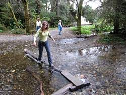 |
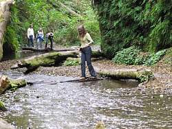
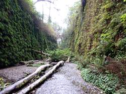
The trail starts by crossing the small stream, and then did it again and again!
|
|
|
|
|
|
|
|
|
|
|
|
|
|
|
|
|
|
|
|
|
|
|
|
|
|
|
|
|
 |
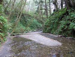
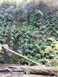
This is the entrance to Fern Canyon and the trail leads north along the coast
|
|
 |
More Fern Canyon visitors
|
|
 |
A banana slug
|
|
 |
Further inland, near the 'Big Tree'
|
|
|
|
|
|
|
|
|
 |
Off the coast of Crescent City, a little north of the parks
|
|
|