Photos of VenturaCountyTrails. Click on an image to see it full size.
 |
Google Earth view of the Maligne Canyon hike. Unfortunately, Google doesn't have very high resolution satellite photos for this area. The trail is shown in brown near the bottom. Medicine Lake can be seen at the top-right.
|
|
 |
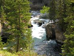
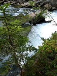
The first waterfall visible from Bridge #1
|
|
 |
Maligne Canyon is very deep and narrow. You can't even see the stream at the bottom here!
|
|
 |
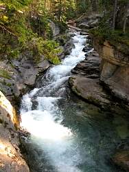
A little further down the canyon is a little wider so now you can see the water at the bottom
|
|
 |
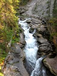
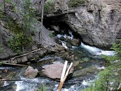
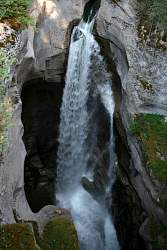
Waterfalls under one of the several bridges
|
|
 |
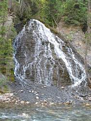
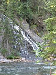
Water dripping down from a side stream
|
|
|
|
|
|
|
|
 |
A small purple flower hangs over the rapids
|
|
 |
An underground stream brings water from Medicine Lake to join this one. There is so much water added from underground streams and springs that there's at least twice as much water at the bottom of Maligne Canyon as at the top
|
|
 |
Another stream adds to Maligne River
|
|
|
|
 |
The river is much wider at the bottom of the canyon. This is as far as I hiked down.
|
|
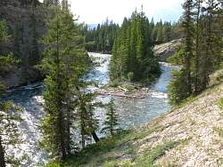 |
The river is much wider at the bottom of the canyon. This is as far as I hiked down.
|
|
 |
I took a few pictures on the way back up to the top
|
|
 |
The top-most waterfall, visible from Bridge #1
|
|
 |
The very top of the canyon
|
|
|