Photos of VenturaCountyTrails. Click on an image to see it full size.
 |
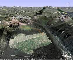
View of Helmcken Falls from Google Earth. The falls are just above the path along the edge of the canyon, shown by the brown line. Upstream, at the top left, is Dawson Falls. Clearwater River is at the bottom.
|
|
 |
View of the Trophy Mountain Trail from Google Earth. Trophy Mtn in on the left with Raft Mtn on the right side. The trail is shown by the brown line.
|
|
 |
Two entryways for the animal(s) that live in this tree
|
|
 |
The viewpoint for Spahats Falls (top right)
|
|
 |
Spahats Falls
|
|
 |
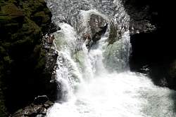
A closer look at Spahats Falls
|
|
 |
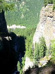
The river is cutting a gorge above Spahats Falls
|
|
 |
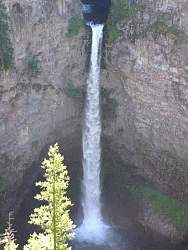
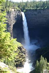
First view of Helmcken Falls
|
|
 |
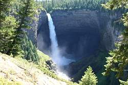
A closer view of Helmcken Falls
|
|
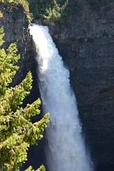 |
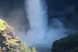
There's a lot of water going over Helmcken Falls!
|
|
 |
There's a smaller falls dowstream of Helmcken Falls. It's hard to see with the sun shining on it in this photo.
|
|
 |
Here's a closer view of the downstream falls
|
|
 |
An even closer view
|
|
 |
Helmcken and downstream falls
|
|
 |
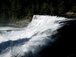
There's a lot of power in that water when it hits the pool!
|
|
|
|
 |
One last look at Helmcken Falls
|
|
 |
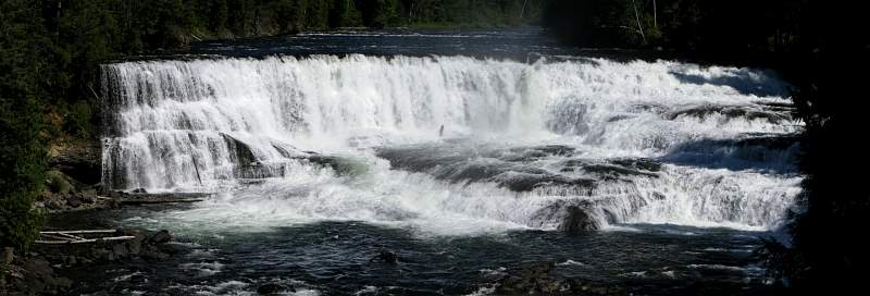
Dawson Falls
|
|
 |
The left side of Dawson Falls as seen from the right bank
|
|
 |
Another view of the left side of Dawson Falls, from downstream
|
|
 |
The trail to Trophy Mountain
|
|