|
View of our route, courtesy of Google Earth, looking south-west. Las Llahas trail is along the bottom of the canyon from the upper-left to about the middle. The Old Quarry Trail turns sharply and heads uphill somewhat steeply.
|
|
 |
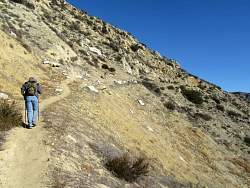
Near the bottom of the Old Quarry Trail, which turns sharply ahead and heads up to the left.
|
|
 |
You can see from the people where the trail turns.
|
|
 |
Looking back down, and basically north, at the junction with Las Llahas.
|
|
 |
Looking south, with Las Llahas below at the edge of the picture.
|
|
 |
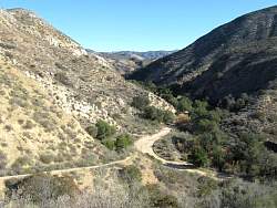
The trail turns west along this side canyon
|
|
|
|
|
 |
A stop for a few minutes to catch our breath and find a geocache.
|
|
 |
You can see a bit of Las Llahas far below
|
|
|
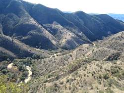 |
In the middle is the narrow trail we hiked up. The wide road is Las Llahas.
|
|
 |
Looking for a geocache in an old rock wall. The footing was a little precarious here!
|
|
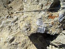 |
Shells in the rocks.
|
|
 |
The geocache is in hand!
|
|
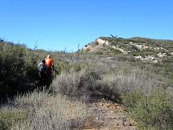 |
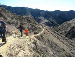
This trail is a little overgrown here. We can see a bit of the old steam shovel at the top of the hill in the distance.
|
|
 |
More old mining artefacts
|
|
 |
Almost to the steam shovel at the top
|
|
 |
The back end of it is bright red. Reminds me of some of those monkeys' butts!
|
|
 |
The old steam shovel, abandoned over 50 years ago.
|
|
|
 |
On the way back down, we see some other people hiking on Las Llahas.
|
|
 |
Almost back to Las Llahas
|
|
 |
The Old Quarry Trail joins Las Llahas. It's easy to miss if you don't know where to look for it.
|
|
 |
The group of geocaching hikers marches in a disciplined and orderly fashion back to the trailhead?
|
|
 |
A street sign and development in the middle of nowhere. This place is for sale.
|
|
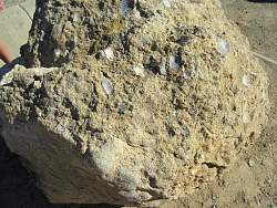 |
At the entrance to the Las Llahas Trail, a boulder full of shells.
|
|