 |
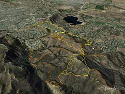
View of our route, looking towards the north-east, courtesy of Google Earth. Our starting point is marked by the red pin in the distance. Bard Reservoir is a little right and above center.
|
|
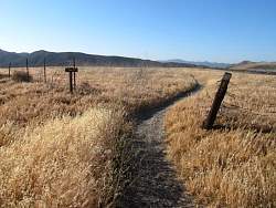 |
Start of the Woodbridge Trail
|
|
 |
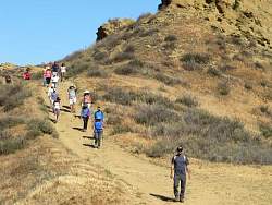
On the Woodbridge Trail
|
|
 |
On the Woodbridge Trail
|
|
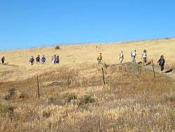 |
On the Woodbridge Trail
|
|
 |
On the Woodbridge Trail
|
|
 |
On the Woodbridge Trail
|
|
 |
Woodbridge Connector Trail
|
|
 |
Woodbridge Connector Trail
|
|
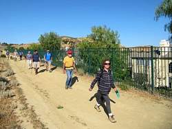 |
Woodbridge Connector Trail at the south edge of the Wood Ranch neighborhood.
|
|
 |
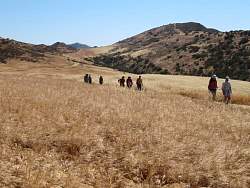
Starting up the Long Canyon Trail in Rancho Simi
|
|
 |
Climbing the Long Canyon Trail
|
|
|
|
 |
Taking a break at the top of the Meadow Vista Trail
|
|
|
 |
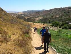
Descending the Meadow Vista Trail
|
|
 |
Turning onto the Hidden Canyon Trail from Meadow Vista
|
|
 |
On the Hidden Canyon Trail
|
|
 |
On the Hidden Canyon Trail
|
|
 |
On the Hidden Canyon Trail
|
|
 |
The Hidden Canyon Trail from the top
|
|
 |
On the Autumn Ridge Trail
|
|
 |
On the Autumn Ridge Trail
|
|
 |
Back to the Woodbridge Loop Trail
|
|
|
|
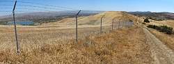 |
Bard reservoir on the left, Woodbridge Loop Trail on the right.
|
|
 |
Just about back to the start, with Boney Mtn in the distance
|
|