 |
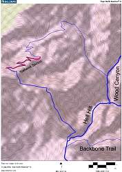
Topo map of Guadalasca Trail, and the section we worked (upper-left). The area that was Sweco'd is shown in bright red; the section that we finished is the darker line within the Sweco's part. North is up.
|
|
 |
Google Earth view of Guadalasca, looking south-west. The area that was Sweco'd and we worked is near the top-right, in red and green. Wood Canyon is at the lower-left and Hell Hill is at the left.
|
|
 |
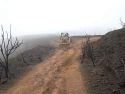
On Wednesday, State Park trail staff Dale drives the Sweco to the top of Guadalasca. Here it comes up Hell Hill, as seen from the Wood Canyon Vista (Backbone) Trail.
|
|
 |
Dale filled in some of the ruts on the old fireroad section on Guadalasca on the way to the singletrack
|
|
|
|
|
|
 |
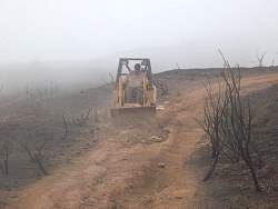
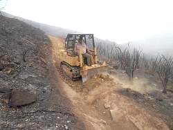
Turning the Sweco onto the singletrack section
|
|
 |
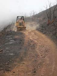
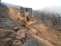
Starting down the singletrack section of Guadalasca
|
|
|
|
 |
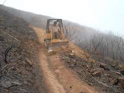
Dale is cutting down the berm and filling in the huge rut at the same time
|
|
|
|
|
 |
The back end lifts off the ground about 6" while trying to pry out this rock
|
|
|
 |
These rocks used to obstacles in the trail
|
|
|
|
 |
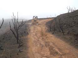
Immediately after the Sweco has levelled the trail, it's pretty rough and loose. We'll fix that in a couple of days!
|
|
 |
The beginning of Saturday's trailwork to fix up the trail that has been Sweco'd
|
|
 |
Gathering at the meeting place, preparing to caravan down to Danielson Multiuse Area
|
|
 |
Learning about the work at Danielson Multiuse Area
|
|
 |
Collecting at the top of Hell Hill, getting ready to hike the 1.3 miles to the start of the singletrack
|
|
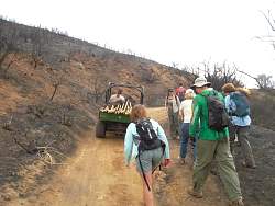 |
Dale carries our tools for us in the Gator
|
|
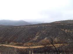 |
On the next ridge is Wood Canyon Vista (Backbone) Trail where we worked last week. The light fans of dirt below the trail show where we installed nicks to drain water off the trail. Hell Hill is at the bottom of the picture
|
|
 |
An old sign has the name misspelled. It should be Guadalasca, with an "A" at the end.
|
|
|
 |
Fingers of brush on the ridge tops survived the fire
|
|
|
|