 |
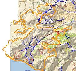
Outline of the Springs Fire burn area (orange), overlaid on a trail and topo map.
|
|
 |
Satellite photo of the burn area (red), taken May 9.
|
|
 |
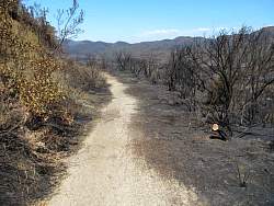
Approaching Serrano Valley along Cotharin Rd
|
|
 |
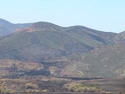
Serrano Valley from Serrano Rd. Part of the road can be seen at the left of the photo.
|
|
 |
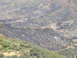
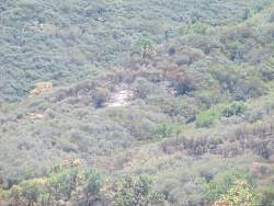
The burned area to the lower left is surrounded by a fire break constructed by the fire fighters to contain the fire
|
|
 |
A closer look at the burned area from the previous photo. You can see the firebreak at the lower right. An unofficial trail is also visible now that the brush has gone.
|
|
 |
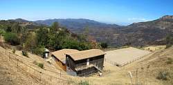
Looking east up the valley at the homes on the edge, in more ways than one! Sandstone peak is in the background somewhere.
|
|
 |
Serrano Rd trailhead
|
|
 |
Serrano Rd winding through Serrano Valley
|
|
 |
Serrano Rd
|
|
 |
Serrano Rd
|
|
|
 |
Looking west across the valley, you can see areas that were spared
|
|
 |
The difficult-to-see ridgeline about 3/4 of the way to the top of this photo is the route of Chamberlain Trail. Below it, about 1/3 of the way up, is an old roadbed?
|
|
 |
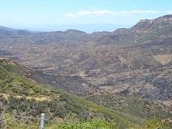
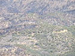
The fire is really patchy around Serrano Valley
|
|
 |
Another panorama of Serrano Valley from Serrano Rd.
|
|
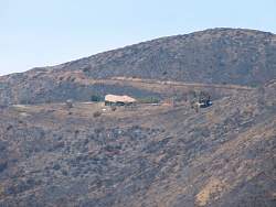 |
This house along Pacific View Rd was saved
|
|
 |
Looking south-east towards Boney Mtn from Potrero Rd in Newbury Park
|
|
 |
A small burned area along the Wendy connector trail. However, the top of the ridge has burned. It looks like there are three people up there (top-right).
|
|
 |
A very small burned area. Caused by flying embers?
|
|
 |
A closer view of the north-west flank of Boney Mtn.
|
|
