 |
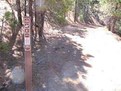
Top of the Chorro Grande Trail
|
|
 |
Chorro Grande Trail
|
|
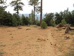 |
Chorro Grande Trail
|
|
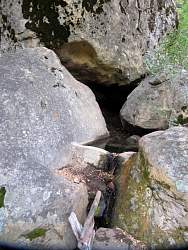 |
This spring is just short of a mile down the Chorro Grande Trail. It still had water in it in early September
|
|
 |
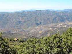
View to the south from the Chorro Grande Trail, with Hwy 33 in the distance far below us
|
|
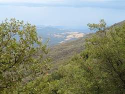 |
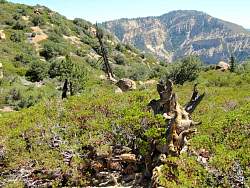
View to the south-west from the Chorro Grande Trail
|
|
 |
This is about where we turned around, just over a mile down. It was pretty steep climbing back up!
|
|
 |
We saw lots of pine cones on the Chorro Grande Trail
|
|
 |
View from the Chorro Grande Trail
|
|
 |
We had an exceptionally clear view of the Channel Islands
|
|
 |
Chorro Grande Trail
|
|
 |
These pine cones come in clusters
|
|
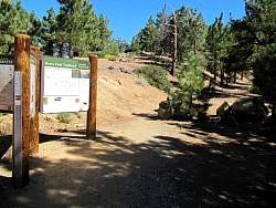 |
This is the end of the road for driving. As well as the trailhead for the Reyes Peak Trail, it's also the starting point for another trail that ends at an old oil well.
|
|
 |
This is an old road and the trail starts off very broad
|
|
 |
The view generally south, with Hwy 33 below us
|
|
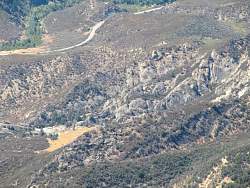 |
There are some interesting rock formations down there
|
|
|
 |
We hiked here the day after Chorro Grande Trail. The view of the Channel Islands wasn't nearly as good today.
|
|
 |
The remnants of the old oil well. Good thing there's no oil pressure here, being full of bullet holes as it is!
|
|
 |
This was the very end of the trail for us
|
|
 |
In the afternoon, we hiked about 2/3 miles down the Boulder Canyon Trail. It was deceptively steep coming back up. Hmm
|
|
 |
There were lots of fallen trees near the trail. This was the largest one we saw.
|
|
 |
The Boulder Canyon Trail doesn't appear to get nearly as much traffic as the Chorro Grande Trail. Here the trail was covered with pine needles.
|
|
 |
View to the north-west from the Boulder Canyon Trail of the Cuyama River
|
|
 |
From here we can see the Lockwood Valley, with some very inhostpitable land north of it.
|
|
|
|
