|
|
 |
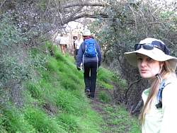
Now where does the trail go?
|
|
 |
Climbing this steep earthen hill to get to the trail, we disturbed this mound of little worms, each about an inch long.
|
|
 |
Climbing up the steep hill. It's so dark here that the pictures are blurred from long exposure times and camera shake
|
|
|
 |
We all made it to the Bay Tree Trail
|
|
|
|
|
|
|
|
 |
The top of the Bay Tree Trail has this sign for those who want to go down it
|
|
 |
We headed up part of Rogers Road that has been bypassed because a landslide took out the trail several years ago
|
|
 |
The trail now works its way around the landslide, at least until the next heavy rain when it might join it's forefather at the bottom!
|
|
 |
From the top of Rogers Road, we take Temescal Ridge FR to the Hub
|
|
 |
Group photo at the Hub Junction
|
|
|
|
 |
Fireroad Thirty back towards the cars, just south of the Hub
|
|
|
 |
Rather than following the fireroad back, we took Bent Arrow singletrack. The distance was about the same, but this trail is prettier than the fireroad
|
|
 |
Bent Arrow has a few switchbacks at the west end
|
|
|
|
|
|
 |
Back on Dirt Mulholland
|
|
 |
Back to the Top of Reseda, almost back to the cars
|
|
 |
Back on Reseda Blvd
|
|
|