|
Route of our hike, in pink, as seen through Google Earth, looking north-west. We started at the lower left corner, hiked up the Oso Ridge Trail to the Preserve High Point, down the Chaparral Crest Trail, then back along the flood plain to complete the loop. Other Rancho El Nido trails are shown in blue.
|
|
 |
The ADA path at the beginning of the trail from the Old Baldwin Road trailhead.
|
|
|
 |
End of the ADA Accessble Trail
|
|
 |
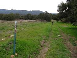
The Lower River Loop Trails splits here
|
|
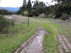 |
The eastern side of the Lower River Loop is really a broad grassway, and a bit muddy in spots
|
|
|
|
 |
I think this is where the Green Chair Trail starts
|
|
|
|
|
 |
In the riverbed, there are arrows on the rocks to mark the way
|
|
 |
This is a 2-way trail!
|
|
 |
Looking back east as we get to the West River Trail.
|
|
 |
Topatopa is in the sun some miles to the north-east
|
|
 |
On the West River Trail
|
|
 |
The Oso Ridge Trail starts with some switchbacks
|
|
 |
Oso Ridge ahead and Chaparral Crest to the right. We're going straight
|
|
 |
There's a bench here to take in the view
|
|
 |
The sun's still shining on Topatopa, but not on us. That helps keep us cool as we climb the ridge
|
|
 |
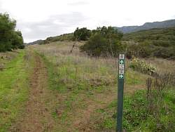
Oso Ridge is quite broad most of the way up
|
|
 |
We'll have a different view of this farmland when we get to the top
|
|
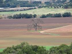 |
An oak tree in the middle of the field
|
|
|
|
 |
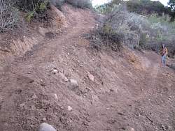
Near the top, the trail diverges from the ridgeline and has some loose, steep switchbacks
|
|
 |
This section of the trail is new since I was last here! The top of the trail isn't as steep as it used to be
|
|
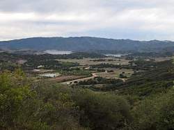 |
View of Lake Casitas from the Preserve High Point at the top of the Oso Ridge Trail
|
|