 |
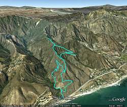
Google Earth view of our route, looking from the southwest. We hiked the lower loop (Corral Canyon Loop Trail) counterclockwise, and the upper loop (Puerco Ridge, Puerco Mtwy and Puerco Meadow Trail) clockwise.
|
|
 |
A kiosk at the trailhead
|
|
 |
A closer look at the map. It doesn't show the Puerco Ridge trail
|
|
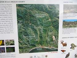 |
On the other side of the kiosk
|
|
 |
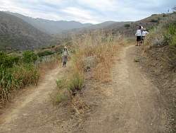
Where the two ends of the Corral Canyon Loop Trail come together. We went counterclockwise, up to the left.
|
|
 |
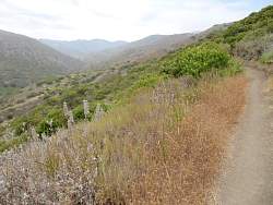
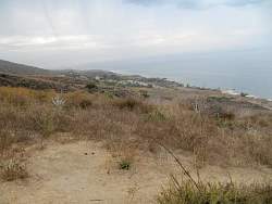
The trail gains altitude quite quickly, giving us great views along the coast, and few traffic sounds from PCH
|
|
 |
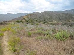
Looking ahead, up Corral Canyon
|
|
|
 |
Looking east from The Overlook
|
|
 |
Looking east from The Overlook
|
|
 |
Now we head up the Puerco Ridge Trail
|
|
 |
Looking back down the Puerco Ridge Trail
|
|
|
|
 |
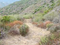
Looking ahead, the Puerco Meadow is to the right and our trail continues up the ridgeline
|
|
 |
Looking back down, Puerco Ridge Trail is left of center. We can see the Corral Canyon Loop Trail below us on the right, and the much fainter Puerco Meadow trail on the left.
|
|
 |
To the west, on the other side of the canyon, are some new trails. I need to find out if they're public or private trails.
|
|
 |
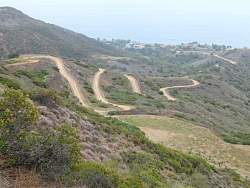
Puerco Canyon Road crests the ridge then heads down into Corral Canyon. It doesn't look like it gets much traffic.
|
|
 |
Puerco Canyon Rd, AKA Puerco Motorway
|
|
 |
Puerco Canyon Road below us, but we're not going all the way down. The meadow is directly below us and we'll be going that way.
|
|
 |
From up above we can see the Puerco Meadow Trail to the west of the meadow.
|
|
 |
There are some ruins here
|
|