We wanted to see where the narrow trails that head north up to the tops of
the ridges go. They turn out to connect to the southmost trail of the Bell Canyon
Homeowners Association. Ahmanson Ranch is also known as the Upper Las Virgenes
Canyon Open Space.
Photos of VenturaCountyTrails.Org. Click on an image to see it full size.
 |
Our hike route, shown in pink. Other trails are blue, red or yellow. We started at the right side and hiked counterclockwise.
|
|
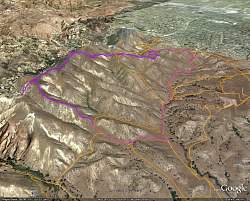 |
Google Earth view of our route, shown in purple, looking from the south-west.
|
|
 |
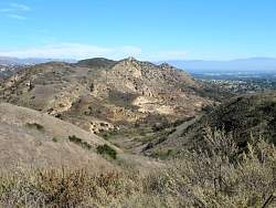
Looking north-east at Castle Peak from part way up the first climb.
|
|
 |
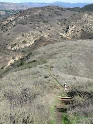
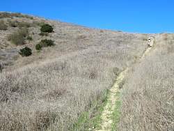
The way ahead, more climbing, with a little rut in the middle of the trail
|
|
 |
We're still a lot lower than Castle Peak, but that will change!
|
|
 |
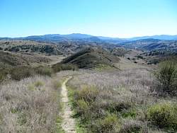
Once we get to the top, the trail is much more rolling with much gentler hills. It would be a half mile of climbing before we got to the top.
|
|
|
|
 |
We're almost even with Castle Peak now.
|
|
 |
Panorama looking south over Ahmanson Ranch
|
|
 |
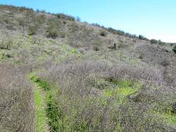
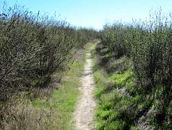
The way ahead - slightly overgrown
|
|
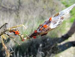 |
Some colorful bugs we saw along the way
|
|
 |
Castle Peak again
|
|
 |
Occassionally we passed an oak tree
|
|
 |
There are lots of oak trees south of us on the lower sections of Ahmanson Ranch
|
|
|
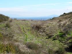 |
The path we came, with the Warner Center in the distance
|
|
|
|
 |
Approaching the Bell Canyon Ridge Trail, we see some people walking their dogs.
|
|
 |
The Bell Canyon Ridge Trail
|
|
 |
Looking east on the Bell Canyon Ridge Trail. Bell Canyon is to the left.
|
|
 |
The west end of the Bell Canyon Ridge Trail
|
|
 |
How do we know the name of this trail?
|
|
 |
Back on an Ahmanson Ranch trail, headed south and mostly downhill from the Bell Canyon Ridge Trail
|
|
|
|
 |
Cheeseboro Ridge to our west
|
|
 |
Our path lies to the right (west) of the hill directly ahead
|
|
 |
Almost back down to the main Ahmanson trails
|
|
 |
Looking back up from where we came
|
|
|