|
Topo map of our hike. We started near the lower left. The main loop is light blue (7.2 miles). The bonus loop is in pink (3.3 miles).
|
|
 |
Google Earth view of our hike, minus the marine layer. The view is from the west, looking east.
|
|
 |
Heading up the La Jolla Canyon Trail.
|
|
 |
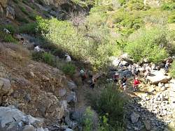
At the waterfall, without the inconvenience of actual water
|
|
 |
This is how the waterfall looked in April, 2005
|
|
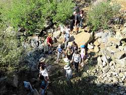 |
Looking down from the top of the waterfall
|
|
|
|
|
|
 |
The La Jolla Valley Loop Trail
|
|
 |
Briefly on the La Jolla Valley Fireroad, recently graded
|
|
 |
Overlook Fireroad
|
|
 |
Boney Mountain to the east
|
|
 |
Sycamore Canyon northeast of us
|
|
 |
Overlook Fireroad
|
|
 |
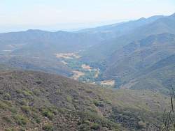
Serrano Valley comes into view east of us
|
|
 |
Overlook Fireroad
|
|
 |
As we hike along Overlook, we get a better view of Serrano Valley
|
|
|
|
 |
Turning onto the Ray Miller Trail
|
|
|