 |
The view from the top towards the southwest
|
|
 |
Steve stands where the trail emerges at the top and is marked by a cairn
|
|
 |
The view from the top of the trail
|
|
 |
It's still cloudy in the Conejo Valley
|
|
 |
The marker indicates old boundaries, shown on the map
|
|
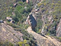 |
From a false peak to the east, we get another view of Balanced Rock
|
|
 |
Zoom out a bit and you can see the Mishe Mokwa Trail in the background
|
|
 |
On top of the false peak, Robert sits on a smaller balanced rock
|
|
 |
Looking towards Westlake Village from the false peak
|
|
 |
Four hikers trying to figure out the best way down from the false peak
|
|
 |
Up on the false peak
|
|
 |
The false peak and small balanced rock on the left end
|
|
 |
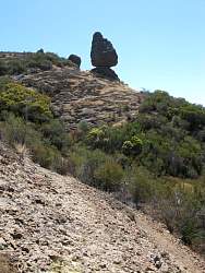
Robert leans against the big Balanced Rock
|
|
 |
Looking back along the Balanced Rock Trail on our way to the Mishe Mokwa Trail at Split Rock
|
|
 |
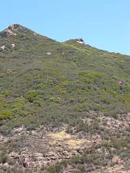
From the Mishe Mokwa Trail we can see the false peak with the small balanced rock on top
|
|
 |
Zooming out a little to show more context, the false peak is the one on the right.
|
|
|
|