|
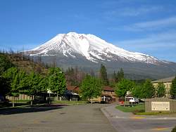
Mount Shasta (Northern California) as seen from a viewpoint on I-5
|
|
 |
Mt. Shasta as seen from the small town of Weed, CA, in the late afternoon.
|
|
 |
The next morning, snow is blowing off the top of Mt Shasta.
|
|
 |
Mt. Shasta from somewhere on Hwy 97, heading further north.
|
|
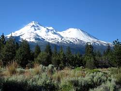 |
A little further north on Hwy 97, you can see both the peak of Mt Shasta (left) and Shastina Crater (right)
|
|
 |
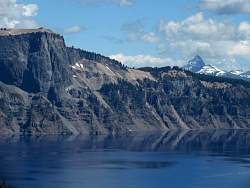
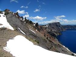
Crater Lake National Park in Oregon
|
|
|
|
 |
There's still snow here in late June - so much that most of the drive around the crater was still closed.
|
|
|
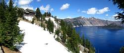 |
Crater Lake Lodge overlooks the lake.
|
|
 |
Crater Lake is famous for its deep blue water
|
|
 |
From an overlook on the west side of the lake, looking south-ish, you see snow in the foreground and two volcanoes in the far far distance.
|
|
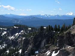 |
A closer look at the volcanoes in the distance: the one on the right is Mt. McLoughlin (36 miles away) and the one on the left is Mt. Shasta and Shastina Cone (106 miles away).
|
|
|
 |
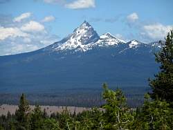
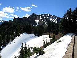
Mt. Thielsen, directly north of Crater Lake.
|
|
|
|
 |
Rhododendrons at the side of the road. I saw these when I was stopped for road construction.
|
|
|
 |
A 12-foot wide wooden pipe carries water for an electric project. It has a few leaks in it...
|
|
 |
... See the leak? There are lots more, to be revealed later!
|
|
|
|
|
 |
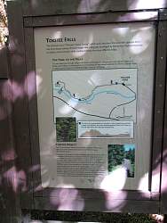
On the way to Toketee Falls, in Oregon, near Diamond Lake.
|
|
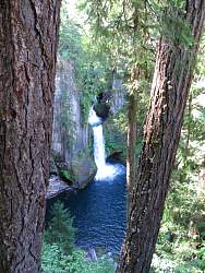 |
My first view of Toketee Falls. The hike to get here from the parking couldn't have been much more than a mile.
|
|
 |
There are other falls above the main one.
|
|
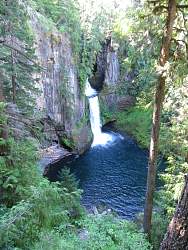 |
I guess this is the iconic view
|
|
 |
The falls have undercut the face of the cliff in a big way!
|
|
 |
As promised, you can see more leaks in the wooden pipe.
|
|
 |
Chanticleer Point along the Columbia River Gorge, a little east of Portland, Oregon.
|
|
 |
The view up the Columbia River Gorge from Chanticleer Point
|
|
 |
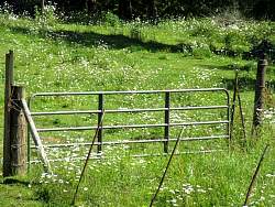
A meadow next to Larch Mountain Road on the south side of the Columbia River Gorge.
|
|
|
|
 |
Larch Mountain Road
|
|
 |
Sherrard Point at the top of Larch Mountain. The next few photos show the view from Sharrard Point.
|
|
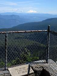 |
Mt. Adams, 56 miles to the north-east.
|
|