 |
My route (green) to the back side of Factory Butte (upper-right corner). This looks like an offshoot of the Waterpocket Fold that runs along the east edge of Capital Reef National Park.
|
|
 |
The normal view of Factory Butte from directly south on Hwy 24.
|
|
 |
Heading north on Cathedral Road towards the turnoff that will take me to Factory Butte.
|
|
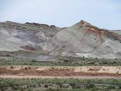 |
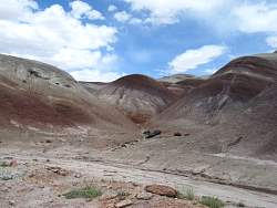
There are lots of colors in the hills!
|
|
|
|
 |
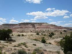
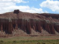
The valley that leads to Factory Butte has characteristic rodk formations of the Waterpocket Fold.
|
|
 |
Factory Butte from the north-west.
|
|
 |
Factory Butte is to the left, the North Caineville Butte to the right and the Henry Mountains in the middle with a little snow on top.
|
|
 |
Waves of dirt wash against the base of Factory Butte
|
|
 |
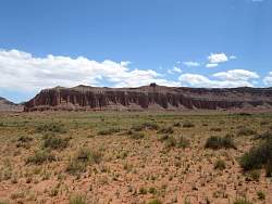
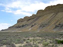
There's a better view of the Waterpocket Fold-like rocks from here
|
|
|
|
|
|
 |
Back on Cathedral Road headed north towards Cathedral Valley.
|
|
|
|
|
|
|
|
|
 |
There were lots of these pillar-like formations as I got futher north.
|
|
|
|
|
 |
A black rock of basalt lying on the dirt demonstrates the volcanic history of the area. That's the Temple of the Sun behind in the distance.
|
|
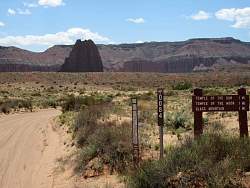 |
You can see the Temple of the Sun from here
|
|
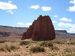 |
The Temple of the Sun
|
|
 |
From center to left: Glass Mountain, Temple of the Sun, Temple of the Moon.
|
|