|
View of our route in blue, looking east, courtesy of Google Earth.
|
|
|
|
 |
We had lots of views down into Camarillo
|
|
 |
This is where we join the Edison Road from the trail that bypasses the houses at the bottom of the mountain.
|
|
 |
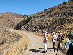
The road is a little rocky.
|
|
 |
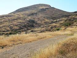
It's still pretty bare from the Springs Fire, two years ago
|
|
 |
Cresting the top of the hill, we get a look into the valley to the north
|
|
|
|
|
|
|
|
|
|
|
 |
I thnk these are due to ground bees, but we didn't see any kinds of insects around.
|
|
|
|
 |
This is where we turned around, at the entrance to the Index Finger Trail
|
|
 |
The moon is a nice touch!
|
|
 |
On the way back
|
|
 |
It's rocky over here, too.
|
|
|
|
|
|
 |
One of my favorite spots on this hike! You have to push the button to understand, it doesn't work the way you expect at a crosswalk.
|
|
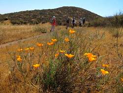 |
There are still a few poppies in bloom
|
|
|
|
 |
The buckwheat is colorful
|
|
 |
Time for lunch!
|
|