Route of our hike, in pink, as seen through Google Earth, looking north-west. We started at the lower left corner, hiked up the Oso Ridge Trail to the Preserve High Point, down the Chaparral Crest Trail, then back along the flood plain to complete the loop. Other Rancho El Nido trails are shown in blue.
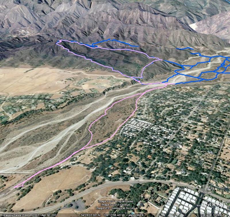
Image 1 of 50
