 |
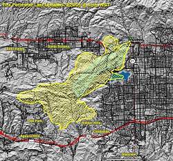
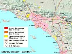
Map of the burned area. Pete pointed us to this map - Thanks!
|
|
 |
The map of the the burned area laid on top of the trails, shown as blue lines. The cluster of trails just below center is the Cheeseboro area. The major "vertical" trails, left to right, are Palo Comado Canyon, Cheeseboro Canyon, Cheeseboro Ridge and Las Virgenes Canyon. These areas are essentially completely burned. The northern boundary is Albertson Fireroad south of Wood Ranch. The Bell Canyon Trail is completely burned. To the east, almost all of Ahmanson Ranch is burned. At the far north it looks like part of the Rocky Peak Fireroad was burned and most of Hummingbird Trail as well.
|
|
 |
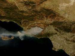
Satellite photo of the Topanga Fire, Wednesday, Sept 28, 1:00 pm.
|
|
 |
False color satellite photo of the Topanga Fire, Thursday, Sept 29, 10:00 am.
|
|
 |
Satellite photo of the Topanga Fire, Thursday, Sept 29, 10:00 am.
|
|
 |
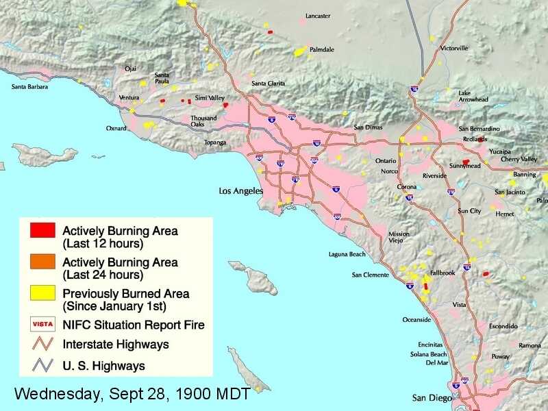
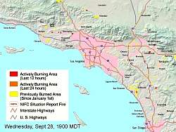
Map of fires in Southern California, from the USDA This one is from Wednesday Sept 28 at 2:00 pm PDT, just before the Topanga fire started.
|
|
 |
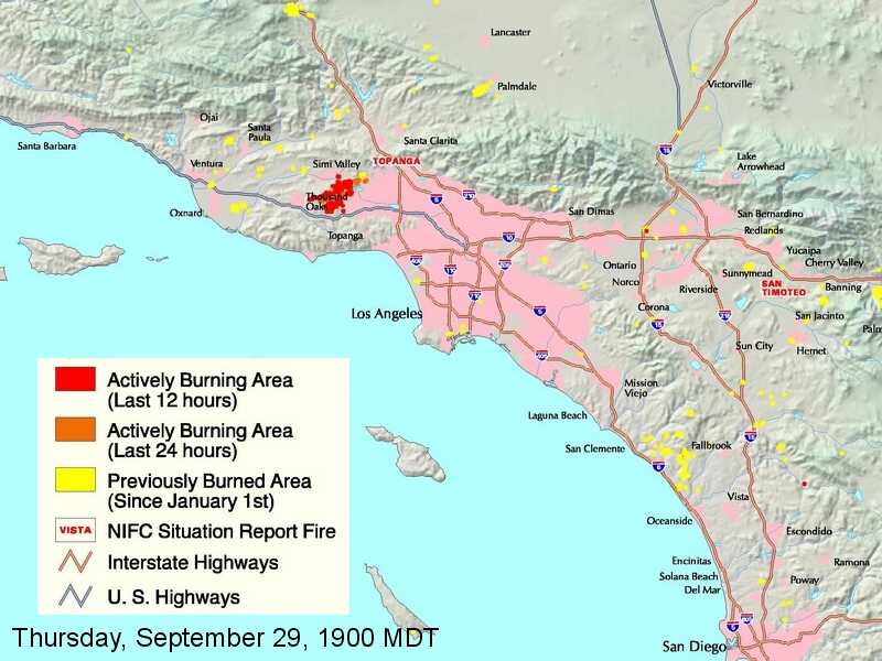
By 6:00 pm, the Topanga fire can be seen, just below the right end of the "Simi Valley" label.
|
|
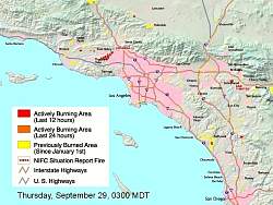 |
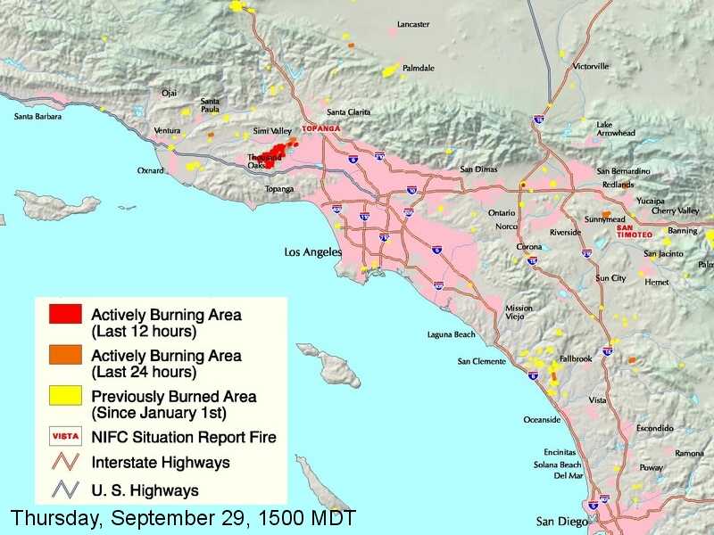
By 2:00 am Thursday morning, the fire has spread all the way to Oak Park!
|
|
|
|
|
|
|
|
|
|
|
 |
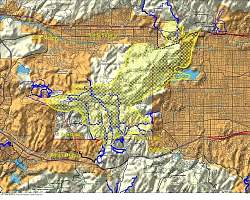
This map, from Saturday at 2:00 am, is the first that shows no active burning area.
|
|
|
|
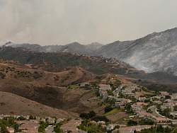 |
Albertson Fireroad, from Lang Ranch. Courtesy of Bob (rmwaprice)
|
|
 |
Lang Ranch. Courtesy of Bob (rmwaprice)
|
|
 |
Simi Peak. Courtesy of Bob (rmwaprice)
|
|
 |
Top of Albertson Fireroad, from Wood Ranch. Courtesy of Bob (rmwaprice)
|
|
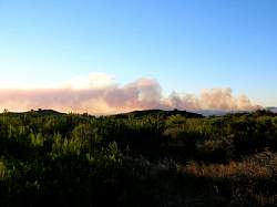 |
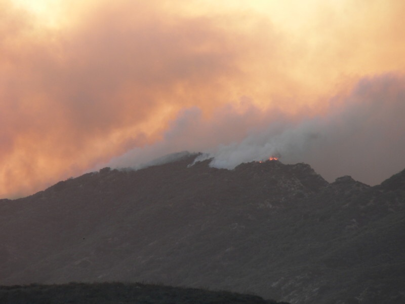
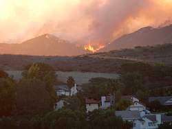
Photo courtesy of Bonnie.
|
|
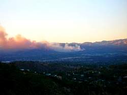 |
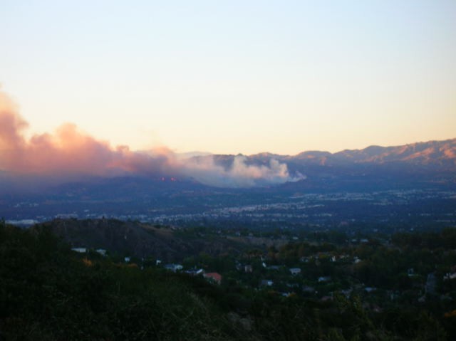
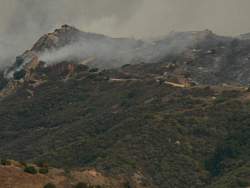
Photo courtesy of Bonnie.
|
|